
Start here
The 3 places worth the trip


Places near Clay by type
All 277 places by distance →One day from Clay
5 stops, one loop, back by 5:11 pm
87 km on the road, in driving order so you don’t double back. Times assume an 8 am start and typical visit lengths.
- Leave Clay
- Chinquapir Ridgeviewpoint · 1 hrs
- Big Canoe Creek Nature Preservenature spot · 2 hrs
- Hayes Mountainviewpoint · 1 hrs
- Brushy Mountainviewpoint · 1 hrs
- Ruffner Mountainnature spot · 2 hrs
- Back in Clay
Questions people ask
What are the best places to visit near Clay?
Big Canoe Creek Nature Preserve (nature spot, about 19 km), Praytor Mountain (viewpoint, about 2 km), Foster Mountain (viewpoint, about 2 km), Ruffner Mountain (nature spot, about 23 km), Black Oak Mountain (viewpoint, about 3 km), Butler Mountain (viewpoint, about 3 km).
How many tourist places are there within 50 km of Clay?
239 places on Spotwander: 67 churches, 62 hill stations & viewpoints, 46 lakes, dams & reservoirs, 36 forts & heritage, 7 wildlife, forests & gardens.
Which is the nearest church to Clay?
Argo Church, about 6 km by road; Mount Calvary Presbyterian Church (6 km) is next.
Which is the nearest viewpoint to Clay?
Praytor Mountain, about 2 km by road; Foster Mountain (2 km) is next.
What is a good one-day trip from Clay?
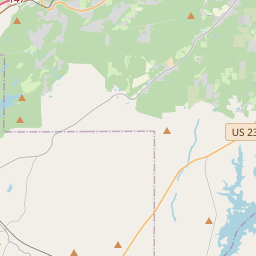
Start in Clay, visit Chinquapir Ridge, then Big Canoe Creek Nature Preserve, then Hayes Mountain, then Brushy Mountain, then Ruffner Mountain, and drive back — about 87 km by road in all.