










Start here
The 3 places worth the trip


Places near Jipijapa by type
All 239 places by distance →One day from Jipijapa
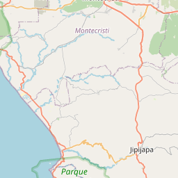
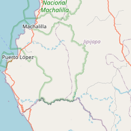
5 stops, one loop, back by 5:29 pm
129 km on the road, in driving order so you don’t double back. Times assume an 8 am start and typical visit lengths.
- Leave Jipijapa
- Cerro Corralitosviewpoint · 1 hrs
- Cerro de La Sillaviewpoint · 1 hrs
- Cerro El Tenibleroviewpoint · 1 hrs
- Parque Nacional Machalillanature spot · 2 hrs
- Cascada de San Nicoláswaterfall · 1.5 hrs
- Back in Jipijapa
Questions people ask
What are the best places to visit near Jipijapa?
Cascadas Recinto Cuenca-Parroquia La America (waterfall, about 2 km), Cerro Corralitos (viewpoint, about 7 km), Cascada de San Nicolás (waterfall, about 14 km), Cerro El Teniblero (viewpoint, about 16 km), Cerro Rodaderos (viewpoint, about 17 km), Cerro de La Silla (viewpoint, about 20 km).
How many tourist places are there within 50 km of Jipijapa?
191 places on Spotwander: 56 churches, 27 hill stations & viewpoints, 29 forts & heritage, 31 parks, 14 beaches & coast.
Which is the nearest church to Jipijapa?
Iglesia San Lorenzo, about 1 km by road; Kingdom Hall of Jehovah's Witnesses, Oeste (1 km) is next.
Which is the nearest viewpoint to Jipijapa?
Cerro Corralitos, about 7 km by road; Cerro El Teniblero (16 km) is next.
What is a good one-day trip from Jipijapa?
Start in Jipijapa, visit Cerro Corralitos, then Cerro de La Silla, then Cerro El Teniblero, then Parque Nacional Machalilla, then Cascada de San Nicolás, and drive back — about 129 km by road in all.