




Visiting Level
Typical pattern: usually quiet; mostly local visitors. Been there recently? Post today’s status and it shows here for the next traveller.
- Sunrise and sunset are the best times; check the sunrise time the day before.
- Fog can hide the view in the monsoon; clear days follow rain in autumn.
- It gets cold at height after dark: carry a layer.
Best time
October to February for cool, clear air; July to September for mist and greenery. Typical week: Mon quiet · Tue quiet · Wed quiet · Thu quiet · Fri light · Sat light · Sun light.
Places to visit near Level
All places near Yadgir →Sri Sri Sri Ambaathraya Kshetram Bijwar
temple · 65 km · Narayanpet
Yadgir Fort
fort · 1 km
Sri Balaji Temple
temple · 1 km
Shri Banadeshwara Temple, Kalebelagundi
waterfall · 27 km
Shri Gavi Siddalingeshwara Devasthana
temple · 28 km
Chintanahalli Falls
waterfall · 28 km
How to reach Level
From Kalaburagi
About 88 km by road (71 km straight line). Directions · places near Kalaburagi
From Mahbubnagar
About 112 km by road (90 km straight line). Directions · places near Mahbubnagar
From Kurnool
About 177 km by road (142 km straight line). Directions · places near Kurnool
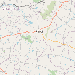
Nearest towns with a guide: Yadgir (1 km) · Gurmatkal (36 km) · Shahpur (41 km). Coordinates 16.76741, 77.14108. Road distances are estimates.
Frequently asked
What is the best time to visit Level?
October to February for cool, clear air; July to September for mist and greenery. Usually quiet; mostly local visitors.
How far is Level from Kalaburagi?
Level is about 88 km by road from Kalaburagi (71 km straight line), 112 km from Mahbubnagar and 177 km from Kurnool. Open the road-trip planner on Spotwander for turn-by-turn directions and stops on the way.
What are the places to visit near Level?
Nearby: Sri Sri Sri Ambaathraya Kshetram Bijwar (temple, 65 km), Yadgir Fort (fort, 0 km), Sri Balaji Temple (temple, 1 km), Shri Banadeshwara Temple, Kalebelagundi (waterfall, 27 km), Shri Gavi Siddalingeshwara Devasthana (temple, 28 km), Chintanahalli Falls (waterfall, 28 km).
Sources. Map data © OpenStreetMap contributors (ODbL). Credits.