


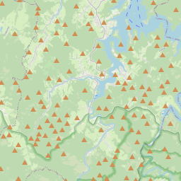


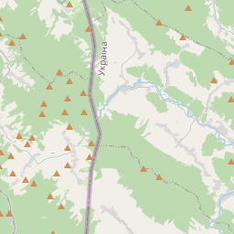


Visiting Żołoby
Typical pattern: usually quiet; mostly local visitors. Been there recently? Post today’s status and it shows here for the next traveller.
- Go at sunrise or sunset for the best light; carry a warm layer.
Best time
May to September. Typical week: Mon quiet · Tue quiet · Wed quiet · Thu quiet · Fri light · Sat light · Sun light.
Places to visit near Żołoby
All places near Lutowiska →
Pradawne I Pierwotne Lasy Bukowe Karpat I Innych Regionów Europy - Połonina Wetlińska I Smerek
sanctuary · 4 km
Pradawne I Pierwotne Lasy Bukowe Karpat I Innych Regionów Europy - Pasmo Graniczne I Dolina Górnej Solinki
fort · 10 km · Zakarpattia Oblast
Pradawne I Pierwotne Lasy Bukowe Karpat I Innych Regionów Europy - Dolina Potoku Terebowiec
sanctuary · 20 km
Pradawne I Pierwotne Lasy Bukowe Karpat I Innych Regionów Europy - Dolina Potoku Wołosatka
sanctuary · 24 km · Zakarpattia Oblast
Jaskinia Jawornicka
cave · 4 km
Wodospad Szepit
waterfall · 6 km
Other hill stations & viewpoints nearby
Kamienna / Kamenná Lúka · District of Snina11 kmКременець / Krzemieniec / Kremenec · Uzhhorod Raion12 kmŁuhy · Sambir Raion18 kmTarnica · Bieszczady22 kmKrzemień · Bieszczady22 kmHalicz · Zakarpattia Oblast25 kmAll hill stations & viewpoints in Subcarpathian Voivodeship →
How to reach Żołoby
Nearest towns with a guide: Lutowiska (18 km) · Cisna (20 km) · Czarna (25 km). Coordinates 49.17031, 22.53618. Road distances are estimates.
Frequently asked
What is the best time to visit Żołoby?
May to September. Usually quiet; mostly local visitors.
What are the places to visit near Żołoby?
Nearby: Pradawne I Pierwotne Lasy Bukowe Karpat I Innych Regionów Europy - Połonina Wetlińska I Smerek (sanctuary, 4 km), Pradawne I Pierwotne Lasy Bukowe Karpat I Innych Regionów Europy - Pasmo Graniczne I Dolina Górnej Solinki (fort, 10 km), Pradawne I Pierwotne Lasy Bukowe Karpat I Innych Regionów Europy - Dolina Potoku Terebowiec (sanctuary, 20 km), Pradawne I Pierwotne Lasy Bukowe Karpat I Innych Regionów Europy - Dolina Potoku Wołosatka (sanctuary, 24 km), Jaskinia Jawornicka (cave, 4 km), Wodospad Szepit (waterfall, 6 km).
Sources. Map data © OpenStreetMap contributors (ODbL). Credits.